Results
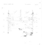
- Plans detail after deck house plating for steamers ETRURIA – 604; BRANSFORD – 605; SMITH, L. C. – 606; JENKS, J. M. – 317. Plans dated Nov 18 1901.Plans detail after deck house plating for steamers ETRURIA – 604; BRANSFORD …
- - Inscription written in ink "V-4" - JENKS, J. M. – [Hull #317]; ETRURIA – [Hull #604]; BRANSFORD – [Hull #605]; SMITH, L. C. – [Hull No. 606]- Inscription written in ink "V-4" - JENKS, J. M. – [Hull …
- A plan detailing the after quarters arrangement of a bulk carrier for Inland Steel Company by H.C. Downer & Associates Inc. (Cleveland, OH). Plan dated August 29, 1958.A plan detailing the after quarters arrangement of a bulk carrier for …
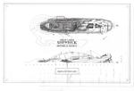
- Archaeological site plan drawn by C. Patrick Labadie for the Great Lakes Shipwreck Historical Society dated summer of 2004.Archaeological site plan drawn by C. Patrick Labadie for the Great Lakes …
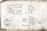
- "Windlass Deck Arrangement 1906""Windlass Deck Arrangement 1906"
- Archaeological site map of Indian River barge project in 1991.Archaeological site map of Indian River barge project in 1991.
- Archaeological site map of JOHN J. AUDUBON showing above viewArchaeological site map of JOHN J. AUDUBON showing above view
- Archaeological site map of Ocean Freighter Viator shipwreck within Thunder bay National Marine Sanctuary's boundaries. Drawn by C. Patrick Labadie.Archaeological site map of Ocean Freighter Viator shipwreck within Thunder bay National …
- Archaeological site map of COMET drawn by C. Patrick Labadie in 2007.Archaeological site map of COMET drawn by C. Patrick Labadie in 2007.
- An archaeological site map of the wrecked Schooner Cornelia B. Windiate drawn by C. Patrick Labadie in February 2004 based on field work conducted by NOAA-TBNMS in July 2003.An archaeological site map of the wrecked Schooner Cornelia B. Windiate drawn …
- 1998 Archaeological Site Map of Scow Schooner W.R. Hanna drawn by C. Patrick Labadie for Inland Seas Maritime Museum.1998 Archaeological Site Map of Scow Schooner W.R. Hanna drawn by C. …
- Archeological site plan detailing the steamer SAMUEL MATHER built in 1887. Plan drawn by C. Patrick Labadie in 2004-2005.Archeological site plan detailing the steamer SAMUEL MATHER built in 1887. Plan …
- Drawn by C. Patrick Labadie for the Great Lakes Shipwreck Historical Society in the Fall of 2005. Details Steamer Vienna wreck site.Drawn by C. Patrick Labadie for the Great Lakes Shipwreck Historical Society …
- An archaeological site map of the steamer JOHN B. COWLE drawn by C. Patrick Labadie for the Great Lakes Shipwreck Historical Society in the summer of 2007.An archaeological site map of the steamer JOHN B. COWLE drawn by …
- -Written in ink "V-3" -JENKS, J. M. – [Hull #317]; ETRURIA – [Hull #604]; BRANSFORD – [Hull #605]; SMITH, L. C. – [Hull No. 606]-Written in ink "V-3" -JENKS, J. M. – [Hull #317]; ETRURIA – …
- STR. L.C. SMITH - 606STR. L.C. SMITH - 606


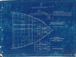
![Arrangement Drawing of Two-mast Schooner Schooner [British Coaster] Arrangement Drawing of Two-mast Schooner Schooner [British Coaster]](https://images.ourontario.ca/Partners/ACPL/ACPL003704942t.jpg)


